
Garmin GPS 73
4.4Editor score
Includes SAILASSIST sailing features
Over 18 hours battery life
Intuitive backlit button interface
Navigating open waters requires reliable tools to ensure safety and efficiency on every trip. A handheld GPS for boating provides critical position data, route planning, and emergency features that standard charts cannot match. Choosing the right device means balancing rugged durability with advanced mapping capabilities to suit your specific vessel type.
We evaluated ten leading models based on satellite accuracy, display readability in sunlight, and specialized marine features like MOB alerts. Each unit was scrutinized for water resistance ratings, battery endurance, and ease of use while wearing gloves or standing on a moving deck. This list covers options for casual sailors and professional captains alike.
Each pick in this guide highlights key strengths and potential limitations based on manufacturer specifications and user feedback. You will find detailed comparisons of charting options, communication capabilities, and physical build quality across all ten selections. Please note that product availability and pricing can change frequently, so verify details before purchasing.
4.4Editor score

4.0Editor score
4.2Editor score
As an Amazon Associate we earn from qualifying purchases.
This side-by-side comparison outlines the core specifications and unique attributes of each selected handheld GPS unit to facilitate informed decision-making for boaters.




The Garmin GPSMAP 79sc stands out as a top-tier navigation tool designed specifically for marine environments. With a 4.0 rating, it offers a robust combination of charting and durability. Its standout quality lies in the preloaded BlueChart g3 coastal charts which provide immediate utility upon unboxing.
We may earn a commission when you buy through this link, at no additional cost to you.
This device supports multiple satellite constellations including GPS, GLONASS, and Galileo to ensure reliable tracking globally. The 20-hour battery life in GPS mode means you can rely on it through long days at sea. The built-in 3-axis tilt-compensated electronic compass provides heading data even when standing still which is crucial for maneuvering.
While the unit is rugged and water-resistant to IPX6 standards, it is not submersible so care is needed during heavy rain or splashes. The higher price point reflects the premium chart data and specialized marine features it includes. These trade-offs are acceptable given the safety and navigational confidence it provides boaters.
Boaters who need immediate access to coastal charts without additional downloads will find this unit invaluable. It is also ideal for those who require a floating device that survives accidental drops overboard. We recommend it as the best overall choice for serious sailors prioritizing chart accuracy and build quality.
The included BlueChart g3 data removes the need for manual map downloads saving time before every trip. This ensures you have detailed coastal information ready to use immediately upon powering on the device.
Engineered to float and resist water damage this unit survives drops into the ocean which is a common risk on small boats. The fogproof glass maintains visibility in humid conditions ensuring you can read data clearly.
We may earn a commission when you buy through this link, at no additional cost to you.
The Garmin GPSMAP 79s offers a slightly different approach with a worldwide basemap instead of detailed coastal charts. With a 4.2 rating, it is a strong contender for travelers who cruise across different regions frequently. Its primary strength is the global coverage which eliminates the need for regional chart purchases.
We may earn a commission when you buy through this link, at no additional cost to you.
Like the 79sc this unit supports multiple satellite systems for optimal accuracy in challenging locations. The floating design ensures it stays afloat if dropped overboard providing peace of mind. It also features a barometric altimeter which helps track changes in pressure for altitude pinpointing.
The lack of preloaded coastal charts means you may need to purchase or download specific maps for detailed navigation. However the worldwide basemap serves well for general positioning and route planning across vast distances. This trade-off is acceptable for international sailors prioritizing flexibility over local detail.
This device is best suited for boaters who travel internationally or need a backup unit that works anywhere globally. It combines essential marine features with a durable build that withstands harsh conditions. We recommend it for those seeking a versatile handheld solution for broad oceanic journeys.
The worldwide basemap ensures you have a navigation reference wherever you sail without needing to buy region-specific charts. This makes it an ideal choice for sailors exploring new coastal areas frequently.
Support for GPS GLONASS and other constellations means you maintain signal lock even in areas with partial sky visibility. This reliability is essential for safety when navigating through narrow channels or storms.
We may earn a commission when you buy through this link, at no additional cost to you.
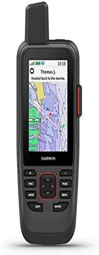
The Garmin GPS 73 is an excellent entry-level option specifically tailored for sailboats and small craft. With a 4.4 rating it offers robust marine features at a budget-friendly price. Its standout qualities include the SAILASSIST suite which provides virtual starting lines and tack assist for racers.
We may earn a commission when you buy through this link, at no additional cost to you.
This unit uses 2 AA batteries which can be easily replaced when they run out extending operation significantly. The built-in alarms for off-course or anchor drag scenarios add an extra layer of safety for overnight anchoring. It stores up to 1000 waypoints which is sufficient for most coastal trips.
While it lacks the high-resolution color display of newer models the screen is adequate for reading critical data. The limited waypoint capacity might be a constraint for very complex routes but it is rarely an issue for day sailing. This simplicity is actually a benefit for users who want straightforward navigation.
We recommend this device for budget-conscious boaters who prioritize sailing-specific tools over advanced mapping. It is a reliable companion for day sailors and racers needing basic position tracking and alerts. This is our top budget pick for those who want essential marine functions without paying extra.
Features like the virtual starting line and speed history help competitive sailors optimize their race performance easily. These tools are often missing from general outdoor GPS units making this a unique choice for sailors.
Using standard AA batteries means you can swap power sources quickly without needing to charge a unit or carry a charger. This ensures you never lose navigation capability due to a drained internal battery.
We may earn a commission when you buy through this link, at no additional cost to you.
The Garmin GPSMAP 86Sci represents a high-end option integrating satellite communication directly into the handheld GPS. With a 4.2 rating it is designed for offshore voyages where cellular signals are unavailable. Its standout feature is the InReach capability allowing two-way text messaging and location sharing globally.
We may earn a commission when you buy through this link, at no additional cost to you.
You can stream data from compatible chartplotters to consolidate information on this handheld unit making it a central hub for data. The adjustable GPS filter smooths speed and heading indications over swells which prevents erratic reading on choppy water. It also includes BlueChart G3 coastal charts for immediate navigation use.
The satellite subscription required for InReach adds to the ongoing cost of ownership which is a significant consideration. Additionally the unit may feel heavier due to the additional communication hardware compared to basic GPS models. However for long-distance cruisers this connectivity offers unmatched safety and communication options.
We recommend this device for offshore cruisers and those venturing far from shore where communication is critical. The ability to send an interactive SOS to search and rescue teams provides essential peace of mind. It is the premium choice for sailors who prioritize safety and real-time data integration.
The InReach satellite network allows you to stay connected even in remote areas where mobile networks fail. This two-way messaging capability is vital for reporting emergencies or updating family about your location safely.
Streaming boat data from your chartplotter allows you to view key instrument readings without constantly looking at the helm. This consolidation reduces workload and keeps navigation information accessible in a single handheld unit.
We may earn a commission when you buy through this link, at no additional cost to you.
The renewed version of the Garmin GPSMAP 79sc offers access to premium features at a reduced price point. With a 4.8 rating it has demonstrated excellent reliability and performance across many users. Its standout quality is the certified refurbishment process that ensures functionality matches new devices.
We may earn a commission when you buy through this link, at no additional cost to you.
This unit includes the preloaded BlueChart g3 coastal charts essential for safe coastal navigation. The rugged floating design ensures it survives drops into water making it a safe choice for active boaters. It supports multiple satellite constellations for accurate tracking around the world.
Buying renewed means accepting potential minor cosmetic imperfections though functional performance should be identical to new. The battery might have some cycle wear compared to a fresh unit but typically retains sufficient capacity for daily use. This is an excellent trade-off for cost-conscious buyers seeking high-end specs.
We recommend this option for boaters who want the 79sc feature set without the full retail price tag. It is ideal for budget-conscious sailors who need reliable charting and rugged durability. This offers the best value for those prioritizing core navigation features over cosmetic perfection.
Renewed units allow access to expensive marine electronics at a fraction of the original cost while maintaining high performance standards. This makes advanced navigation accessible to more sailors without compromising on safety features.
The renewed certification process verifies that the unit functions correctly and meets the manufacturers performance criteria for reliability. This reduces the risk associated with buying used electronics and ensures you get a working device.
We may earn a commission when you buy through this link, at no additional cost to you.
The Garmin eTrex 22x is a versatile navigator suitable for both land adventures and casual boating trips. With a 4.3 rating it provides reliable tracking for users who want one device for all outdoor activities. Its standout quality is the long battery life of 25 hours which extends usability significantly.
We may earn a commission when you buy through this link, at no additional cost to you.
This unit supports both GPS and GLONASS satellite systems which improves tracking accuracy in challenging environments. It comes with 8GB of internal memory and a micro SD card slot allowing you to download detailed maps for various terrains. The 2.2 inch display is sunlight readable ensuring you can see data in bright conditions.
While it lacks specific marine charts like BlueChart g3 it serves well as a general positioning tool on the water. The rugged build is designed for outdoor durability but you should verify water resistance limits before exposing it to heavy spray. This versatility makes it a practical choice for multi-use enthusiasts.
We recommend this device for boaters who also hike or camp and want a unified GPS experience. It offers strong performance at a reasonable price for those who do not need advanced marine software. It is a solid pick for adventurers who need reliability across different outdoor scenarios.
The 25-hour battery life in GPS mode allows for multi-day trips without needing spare batteries or charging. This is particularly useful for extended camping or sailing trips where access to power is limited.
Support for both GPS and GLONASS increases the number of satellites available to lock onto for better accuracy. This ensures you get reliable positioning even in areas with tall trees or steep terrain.
We may earn a commission when you buy through this link, at no additional cost to you.
The Garmin GPSMAP 65 features multi-band technology to provide superior accuracy in difficult navigation environments. With a 4.5 rating it is a favorite among outdoor enthusiasts seeking high precision. Its standout quality is the expanded satellite support which minimizes signal interference and drops.
We may earn a commission when you buy through this link, at no additional cost to you.
This unit offers a large 2.6 inch color display which enhances readability of maps and waypoints. The button-operated interface allows for easy control even when wearing gloves or in rough conditions. It includes routable TopoActive mapping which is useful for navigation on land or inland waterways.
The lack of marine-specific charts means it is better suited for general navigation rather than detailed marine routing. However the high precision GPS makes it useful for marking locations and tracking routes accurately. The build quality is rugged enough to handle drops and harsh outdoor environments.
We recommend this device for boaters who need highly accurate positioning and primarily navigate inland or coastal areas. It is also ideal for those who value display size and button control over touch interfaces. It offers top-tier accuracy for users needing precise location data.
Multi-band GNSS technology reduces signal interference allowing you to maintain a lock in urban canyons or dense forests. This ensures accurate positioning even in areas where standard GPS might struggle with reflections or blockage.
The large color display makes it easier to read map details and waypoints quickly without squinting in bright light. This improves usability on the water where quick access to position data is often critical.
We may earn a commission when you buy through this link, at no additional cost to you.
The Garmin eTrex 32x adds a 3-axis compass and barometric altimeter to its GPS tracking capabilities. With a 4.2 rating it is a versatile tool for navigation that requires precise orientation. Its standout quality is the inclusion of both compass and altimeter for detailed environmental data.
We may earn a commission when you buy through this link, at no additional cost to you.
Like the 22x this model supports GPS and GLONASS for reliable tracking and offers 8GB internal memory plus an SD card slot. The 2.2 inch display is sunlight readable and the device offers up to 25 hours of battery life on 2 AA batteries. This durability ensures it works in various outdoor conditions.
While it lacks marine specific alarms or charts the compass and altimeter provide useful context for navigation. It is robust enough for boating if you only need basic positioning and heading information. The lack of specialized marine software limits its use for complex coastal routing.
We recommend this device for those needing a reliable handheld that tracks position and direction accurately. It suits boaters who need general tracking and orientation without needing detailed charting software. It is a practical choice for users valuing compass utility on the water.
The 3-axis compass shows heading even when the device is standing still which is useful for determining orientation at anchor. This feature adds significant value for navigation compared to basic GPS units.
Tracking pressure changes helps pinpoint precise altitude which can assist in coastal navigation where elevation data matters. This tool adds depth to your navigation data beyond simple latitude and longitude.
We may earn a commission when you buy through this link, at no additional cost to you.
The Garmin eTrex SE is designed for extreme endurance with a battery life of up to 168 hours in standard mode. With a 4.2 rating it offers long-term reliability for extended trips away from charging sources. Its standout quality is the expedition mode that extends life to 1800 hours for multi-week usage.
We may earn a commission when you buy through this link, at no additional cost to you.
This unit features a water-resistant design rated to IPX7 ensuring it can survive temporary immersion in water. Multi-GNSS support provides access to GPS GLONASS Galileo and other systems for robust tracking. It also includes a digital compass for accurate heading even when stationary which is useful for navigation.
While the screen resolution is lower than premium models it remains easy to read in bright sunlight. The lack of marine charts means it serves best for general position tracking rather than detailed route planning. However the IPX7 rating offers excellent water protection for wet environments.
We recommend this device for boaters who prioritize battery life and water resistance above advanced mapping. It is a great backup unit for trips where power availability is uncertain. This makes it a practical choice for those needing long duration navigation without recharging.
With up to 1800 hours of battery life in expedition mode this unit can last for weeks without needing new batteries. This is invaluable for long-distance voyages where power conservation is a primary concern.
The IPX7 rating ensures the unit can survive accidental submersion making it safe for use in wet or rainy conditions. This durability adds a layer of safety for boaters dealing with splashes or rain.
We may earn a commission when you buy through this link, at no additional cost to you.
The Garmin GPS 76 is a classic handheld GPS known for its simple and effective operation. With a 4.6 rating it has maintained high user satisfaction for reliability and accuracy. Its standout quality is the WAAS enabled tracking which ensures precise position data on the water.
We may earn a commission when you buy through this link, at no additional cost to you.
It features a trip computer with current and average speed timer and trip distance which helps track navigation metrics easily. The unit uses 2 AA alkaline batteries for up to 16 hours of use which is sufficient for daily boating. It also tracks up to 12 satellites for optimal signal lock.
The 1MB memory capacity is quite limited compared to modern devices restricting map storage capabilities. This means it functions best as a basic tracker rather than a detailed map navigator. However for simple waypoint and position checking it remains a reliable tool for basic navigation.
We recommend this device for boaters who need a straightforward GPS for basic positioning without complex features. It is a solid choice for small boat owners who want simplicity and accuracy without the cost of advanced units. It provides essential navigation functions for those who prioritize simplicity.
WAAS enabled tracking improves accuracy significantly providing precise position data for safe navigation in narrow channels. This ensures you know exactly where you are relative to hazards or waypoints.
The built-in trip computer allows you to monitor speed and trip distance continuously without needing separate instruments. This simplifies navigation logging and helps you track your journey progress efficiently.
We may earn a commission when you buy through this link, at no additional cost to you.
Selecting the right handheld GPS involves balancing features like charting capabilities battery life and water resistance to match your specific boating needs.
Water resistance is the most critical factor for any device used on the water. Look for units rated at least IPX6 or IPX7 to ensure they can withstand splashes and accidental immersion. A rugged design with reinforced edges helps protect the device from drops and impacts on a hard deck.
Prioritize models with waterproof seals and reinforced build quality to ensure longevity in harsh marine conditions.
Preloaded coastal charts provide immediate navigation safety without requiring additional downloads. Units with BlueChart or similar marine maps allow you to see depth contours and hazards clearly. Consider whether you need detailed offshore charts or just a basic basemap for open water cruising.
Choose a device with preloaded coastal charts to ensure you have essential navigation data immediately upon setup.
Battery life determines how long you can navigate without needing to recharge or replace power sources. Look for units offering at least 20 hours of continuous use or replaceable AA batteries for quick swaps. Long battery life is essential for multi-day trips where access to charging may be limited.
Prioritize models with long battery life or replaceable batteries to ensure continuous navigation capability on extended trips.
Modern GPS units often support multiple satellite constellations like GPS GLONASS Galileo and Beidou. This support improves tracking accuracy and signal reliability especially in challenging environments. Ensure the device supports at least two major systems to minimize signal loss during navigation.
Select a unit with multi-constellation support to ensure reliable tracking even in areas with partial sky visibility.
A sunlight-readable screen ensures you can see data clearly without glare even under direct sun. Choose a display size that balances visibility with portability for handheld use. Fogproof and scratch-resistant glass helps maintain screen clarity and durability over time.
Opt for a large sunlight-readable display with fogproof glass to ensure clear visibility in bright conditions.
Marine features such as MOB Man Overboard alerts and anchor drag alarms add critical safety layers. Look for dedicated sailing features if you operate sailboats like tack assist and starting lines. These specialized tools make navigation safer and more efficient for vessel specific operations.
Look for MOB and alarm features to ensure your device provides essential safety alerts for marine environments.
Advanced models may offer satellite communication like InReach for texting and SOS capabilities without cellular service. This feature is valuable for offshore cruising where radio or phone coverage is unavailable. Ensure you understand any subscription requirements before purchasing a communication-enabled device.
Consider satellite communication options if you venture far from shore where standard radio communication is not available.
Memory capacity determines how many waypoints and routes you can save for future navigation. Units with expandable memory via SD cards allow you to store detailed maps for different regions. Ensure the device has sufficient internal memory for your typical navigation planning needs.
Ensure the unit has expandable memory or sufficient internal storage to store necessary waypoints and maps effectively.
Start by charging or inserting fresh batteries before your trip to ensure maximum operating time. Update the software via USB or wireless connection if supported to access the latest maps and features. Set up your initial waypoints and routes at home using software to save time while on the water.
Once on the water turn on the GPS and allow it a few minutes to acquire satellite signal before relying on it. Keep the device in a dry place when not in use and wipe it down with fresh water to remove salt and grime. Regularly check the battery and replace it as needed to avoid unexpected power loss.
To maintain accuracy calibrate the compass by following the on-screen instructions periodically especially after a drop. Store the device in a padded case to protect it from impacts during transport. Review the manual regularly to stay familiar with all alarm settings and safety features for optimal use.
A handheld GPS is portable and can be moved around the boat while a fixed-mount unit is permanently installed at the helm. Handhelds are ideal for small boats or backup use while fixed-mounts offer larger screens and integration with instruments. For safety and versatility many boaters use both types together.
Yes handheld GPS units rely on satellite signals not cellular networks so they work offshore as long as there is a clear view of the sky. Some models also have satellite communication features that allow texting via satellite networks independently. Standard GPS navigation functions remain fully functional even without cellular coverage.
IPX6 indicates protection against powerful water jets while IPX7 means the device can survive temporary immersion in water up to one meter. For boating IPX7 is generally safer as it handles splashes and accidental drops into water more effectively. Always verify the specific rating before exposing your device to heavy spray or rain.
Most modern handheld GPS units last between 18 and 25 hours on a single charge or battery set. Some models with power-saving modes can extend this to hundreds of hours for expedition use. Using AA batteries allows you to swap power sources easily if you need extended runtime.
You can use a standard GPS for position tracking but it lacks marine charts and features like MOB alerts. Dedicated marine handhelds include waterproof ratings and specific safety tools essential for boating safety. For best results choose a unit designed specifically for marine environments to ensure reliability.
Multi-constellation support means the device connects to multiple satellite networks like GPS and GLONASS to improve signal reliability. This helps maintain accurate tracking in areas with partial sky visibility or interference. It ensures you get a stronger connection and better accuracy in challenging navigation zones.
Renewed units offer premium features at a lower price but may have minor cosmetic issues or limited warranties. New units provide full manufacturer support and a fresh battery which is crucial for safety gear. Consider renewed options if you need specific features on a budget and verify the certification process carefully.
Most basic navigation functions like charting and tracking do not require a subscription. However advanced features like satellite messaging or weather data may require a monthly plan. Check the product details carefully to understand any recurring costs before making your purchase.
In summary the Garmin GPSMAP 79sc stands out as the best overall choice for its robust charting and rugged design. Budget-conscious sailors will find the GPS 73 an excellent affordable option with dedicated sailing features. The GPSMAP 86Sci offers top-tier connectivity for offshore needs with satellite communication capabilities.
When selecting your device prioritize water resistance and battery life as these are the most critical factors for safety. Consider your specific navigation needs such as charting depth and sailing features to match your vessel type. Balancing these elements will ensure you get a reliable tool for every trip.
Remember that product availability and pricing can change frequently so verify current details before buying. Check for warranty terms and battery health especially when considering renewed options for your purchase. Staying informed helps you secure the best unit that meets your boating requirements effectively.