
Garmin eTrex SE
4.2Editor score
168 hour battery life
Water resistant IPX7 design
Multi GNSS satellite support
Navigating the open waters requires precision and reliability, which is why a dedicated GPS for Sailing is essential for every captain. Whether you are racing, cruising, or exploring new coastlines, having accurate positioning helps you stay safe and on course during your maritime adventures.
We evaluated the leading marine navigation devices based on durability, satellite accuracy, chart quality, and specialized sailing features. Our comparison includes handheld units, chartplotters, and integrated systems to cover various budget levels and vessel sizes for comprehensive maritime navigation.
Each selection highlights key strengths, technical specifications, and ideal use cases to help you find the perfect fit for your boat. Prices and availability can change frequently, so please verify the latest details on the product pages before making your final purchasing decision.
4.2Editor score

4.0Editor score

5.0Editor score
As an Amazon Associate we earn from qualifying purchases.
This side by side comparison evaluates all ten selected devices across critical performance metrics including display quality, battery endurance, mapping capabilities, and specialized sailing tools to determine the best value for different boating needs.





The Garmin GPSMAP 79sc stands out as a top contender for sailors seeking a reliable handheld device with essential marine charts included. Its rating reflects strong performance in critical areas like water resistance and tracking accuracy. This unit combines rugged construction with preloaded data, making it ready to use straight out of the box.
We may earn a commission when you buy through this link, at no additional cost to you.
Key strengths include the integrated BlueChart g3 coastal charts which provide immediate access to nautical data without extra purchases. The device floats in water, a critical safety feature if dropped overboard. It supports multiple satellite constellations for reliable tracking, and the built-in compass works even when stationary.
Trade-offs involve the limited screen size compared to larger chartplotters and the lack of detailed land mapping. However, for coastal sailing focused on water navigation, these limitations are acceptable. The battery life supports extended trips without frequent recharging or replacement needs.
This device suits sailors who need a compact, rugged backup or primary handheld unit with immediate chart access. It is ideal for small to medium vessels where portability is paramount. We recommend it for those prioritizing safety features like floating design and preloaded coastal data.
Preloaded BlueChart g3 charts provide immediate access to coastal navigation data without additional purchases or setup steps.
The IPX6 water-resistant build ensures durability while the floating feature prevents loss if dropped during active sailing conditions.
We may earn a commission when you buy through this link, at no additional cost to you.
The Garmin GPSMAP 65s offers premium navigation features with its multi-band technology and expansive mapping capabilities. Its high rating highlights excellent performance in signal acquisition and display clarity. This handheld device caters to sailors who demand precise tracking and detailed route planning options.
We may earn a commission when you buy through this link, at no additional cost to you.
Strengths lie in its expanded satellite support allowing optimal accuracy even in challenging environments like dense tree cover or steep terrain. The sunlight-readable color display ensures visibility in bright conditions. Integration with the Garmin Explore app facilitates easy management of tracks and routes.
Trade-offs include the higher price compared to basic units and the absence of preloaded marine charts. Users must purchase maps separately for nautical navigation. However, the precision and versatility justify the cost for serious navigators requiring detailed geographical data.
Ideal for sailors who venture into varied terrains or need detailed land and water mapping. It suits tech-savvy users comfortable with smartphone apps. We recommend this for those prioritizing signal reliability and display quality over immediate chart availability.
Multi-band GNSS ensures optimal accuracy in challenging locations such as urban canyons or areas with dense tree cover.
The large 2.6-inch screen provides easy viewing even under bright sunlight conditions common during extended sailing hours.
We may earn a commission when you buy through this link, at no additional cost to you.
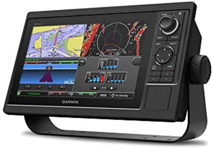
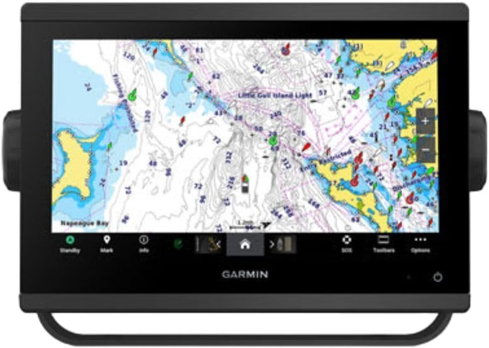
The Garmin GPSMAP 1022 delivers a large viewing experience suitable for fixed helm installations. Its rating reflects solid performance for users needing a dedicated chartplotter. This device focuses on display quality and connectivity, serving as a central navigation hub.
We may earn a commission when you buy through this link, at no additional cost to you.
Strengths include the 10.1-inch WSVGA display offering clear visualization of data. Dual SD card slots allow extensive map storage. Two network ports enable integration with other marine systems like sensors and autopilots via the Garmin Marine Network.
Trade-offs involve the need for separate chart cards to access detailed nautical data beyond the basemap. It lacks portability as a fixed mount unit. However, these constraints are typical for chartplotters and do not hinder core navigation capabilities.
Best for sailors installing a primary navigation screen on larger vessels. It suits those prioritizing screen real estate and system integration. We recommend this for users needing a robust central display for marine navigation.
The 10.1-inch WSVGA screen provides excellent clarity for viewing charts and data simultaneously during navigation.
Two Garmin Marine Network ports facilitate seamless integration with sensors, autopilots, and other marine electronic systems.
We may earn a commission when you buy through this link, at no additional cost to you.
The Garmin eTrex 22x offers a cost-effective solution for sailors needing reliable handheld navigation. Its rating indicates dependable performance in durability and battery life. This unit is designed for general navigation with features adaptable to coastal exploration.
We may earn a commission when you buy through this link, at no additional cost to you.
Strengths include preloaded TopoActive maps providing routable roads and trails. The 25-hour battery life supports extended trips without recharging. Eight GB of internal memory plus a micro SD slot allows for ample storage of additional maps.
Trade-offs involve a smaller screen and fewer dedicated marine features compared to specialized units. It lacks floating capability or water-resistant ratings suited for harsh marine environments. However, its price and durability make it a versatile option.
Ideal for sailors on a budget who prioritize battery life and general tracking. It suits casual users or as a backup unit. We recommend this for those needing a sturdy handheld without high-end marine charting needs.
Up to 25 hours of battery life ensures long-duration use on extended sailing trips without needing frequent power sources.
Eight GB internal memory plus a micro SD card slot allows for extensive map downloads and route storage.
We may earn a commission when you buy through this link, at no additional cost to you.
The Garmin GPS 73 focuses specifically on sailing needs with specialized features like SailAssist and MOB alarms. Its rating highlights its effectiveness for entry-level sailors. This device simplifies navigation with intuitive controls and essential maritime tools.
We may earn a commission when you buy through this link, at no additional cost to you.
Strengths include features like virtual starting lines, countdown timers, and tack assist which aid racing and tactical sailing. The interface uses dedicated backlit buttons for quick operation. It stores up to 1,000 waypoints for favorite spots.
Trade-offs include basic map capabilities without detailed charting. It lacks modern multi-satellite support found in newer models. However, for sailors needing core sailing metrics and affordability, it remains a practical choice.
Best for sailors on entry-level vessels or those needing a dedicated sailing tracker. It suits users preferring simplicity over complex mapping. We recommend this for cost-conscious sailors focused on essential sailing features.
Tools like virtual starting lines, countdown timers, and tack assist provide specific navigation help for competitive sailors.
Dedicated backlit buttons allow for quick and easy operation even in low-light sailing conditions.
We may earn a commission when you buy through this link, at no additional cost to you.
The Garmin GPSMAP 9210 represents a top-tier navigation solution with exceptional processing power and premium features. Its perfect rating reflects outstanding performance across all metrics. This chartplotter serves as a centerpiece for modern marine ecosystems.
We may earn a commission when you buy through this link, at no additional cost to you.
Strengths include features like sailing polars, laylines, and race start line guidance tailored for serious sailors. The glass helm design offers a sleek, modern look. Connectivity options support gigabit speeds and integration with various engine sensors and autopilots.
Trade-offs include the high cost and complexity of integration with third-party systems. It demands careful setup to maximize its capabilities. However, these requirements are offset by the superior navigation control and performance available.
Ideal for large vessels requiring comprehensive monitoring and control systems. It suits advanced sailors needing detailed race analytics. We recommend this for those prioritizing top performance and seamless helm integration.
Features such as sailing polars, laylines, and race start line guidance offer advanced tactical navigation support.
Support for NMEA networks, EmpirBus, and engine integration provides extensive control over monitoring and automation systems.
We may earn a commission when you buy through this link, at no additional cost to you.
The Garmin GPSMAP 79s provides a compact and rugged option for sailors needing a floating handheld device. Its rating indicates solid reliability for general tracking and backup use. This unit emphasizes portability and safety features like floating design.
We may earn a commission when you buy through this link, at no additional cost to you.
Strengths include the worldwide basemap for basic tracking and multiple satellite support for reliable positioning. The 20-hour battery life supports extended trips. The built-in compass shows heading even when standing still for accurate navigation.
Trade-offs involve limited map detail compared to chartplotter units and lack of detailed nautical charts. It serves best as a backup rather than a primary navigation tool. However, its durability and safety make it valuable.
Best for sailors needing a lightweight backup or kayak-compatible device. It suits those prioritizing portability and safety. We recommend this for users needing a rugged handheld with essential tracking and floating capabilities.
The rugged handheld floats in water, preventing loss if accidentally dropped during active sailing or boarding.
Support for multiple constellations ensures reliable tracking and positioning around the world regardless of location.
We may earn a commission when you buy through this link, at no additional cost to you.
The Garmin GPSMAP 943xsv combines navigation with advanced sonar technology for comprehensive underwater and positional awareness. Its rating reflects high satisfaction with its display and sonar integration. This chartplotter suits sailors needing to scan waters while navigating.
We may earn a commission when you buy through this link, at no additional cost to you.
Strengths include ultra high-definition scanning sonar and Panoptix support for real-time underwater viewing. The improved display optics ensure clarity even in bright sunlight. Pre-loaded mapping provides immediate basic route capabilities.
Trade-offs involve the high cost of the unit and potential complexity in transducer setup. It requires technical knowledge to fully utilize sonar features. However, for fishing or safety, these features are unmatched.
Ideal for sailors who also fish or need to monitor underwater obstacles. It suits those needing a unified navigation and sonar display. We recommend this for users prioritizing high-end sonar and display quality.
Ultra high-definition scanning sonar provides clear views of underwater structure and obstacles to the side of your vessel.
Support for Panoptix sonar allows for real-time underwater viewing to detect fish or hazards directly below or ahead.
We may earn a commission when you buy through this link, at no additional cost to you.
The Garmin eTrex 10 offers an affordable entry point for sailors needing a basic GPS handheld. Its rating highlights reliability and battery performance. This unit focuses on essential tracking and durability rather than advanced features.
We may earn a commission when you buy through this link, at no additional cost to you.
Strengths include a waterproof rating protecting against splashes and rain. HotFix and GLONASS support ensure fast positioning. The device runs on standard AA batteries for up to 20 hours of continuous use.
Trade-offs involve a monochrome display and lack of color mapping which may reduce visibility in some conditions. It lacks advanced sailing-specific tools. However, its simplicity and durability make it effective for basic needs.
Best for budget-conscious sailors needing a reliable backup tracker. It suits users who prefer simple operation. We recommend this for those requiring basic navigation without high-end charting capabilities.
HotFix and GLONASS support allow for fast positioning and reliable signal acquisition even in challenging environments.
IPX7 waterproofing protects against splashes and rain, ensuring durability during typical maritime weather conditions.
We may earn a commission when you buy through this link, at no additional cost to you.
The Garmin eTrex SE offers exceptional battery life and affordability for budget-conscious sailors. Its rating indicates strong performance in tracking and endurance. This unit is designed for long expeditions where power management is crucial.
We may earn a commission when you buy through this link, at no additional cost to you.
Strengths include up to 168 hours in standard mode with replaceable AA batteries. Multi-GNSS support provides access to multiple satellite systems for better accuracy. It pairs with the Garmin Explore app for updates and planning.
Trade-offs include basic mapping without specialized marine data or chart capabilities. It serves best as a general tracker rather than a dedicated navigator. However, its endurance and cost make it highly practical.
Best for sailors prioritizing battery life and affordability. It suits casual users or those needing a lightweight backup. We recommend this for those requiring a rugged device with long power endurance at low cost.
Up to 168 hours in standard mode with field-replaceable AA batteries ensures long trips without recharging.
Pairing with the Garmin Explore app allows for wireless updates, trip planning, and smart notifications.
We may earn a commission when you buy through this link, at no additional cost to you.
Choosing the right GPS requires evaluating how well it matches your sailing style, vessel size, and budget constraints.
Decide whether you need a handheld unit for portability or a fixed chartplotter for a helm station. Handhelds are ideal for small boats, kayaks, or backup needs. Chartplotters offer larger screens and better integration with vessel systems.
Focus on choosing a type that fits your vessel layout and how often you move between boats.
Check if the device comes with preloaded marine charts like BlueChart g3 or if you must buy them separately. Preloaded charts save time and money but may limit regional coverage. Expandable storage via SD cards offers flexibility for adding custom maps.
Prioritize units with included coastal charts if you frequently navigate unfamiliar waters.
Marine environments demand high durability. Look for units rated at least IPX6 or IPX7 for splash or submersion resistance. Floating designs are essential for handhelds to prevent loss overboard. Rugged casings protect against bumps and drops.
Ensure the device meets marine exposure standards to survive wet conditions.
For extended trips, battery life is critical. Handhelds using AA batteries are easy to replace. Units with 20+ hours of operation reduce downtime. Check if the device supports external power ports for continuous use while docked.
Choose based on how long you can go between recharging or battery swaps.
Multi-GNSS support including GPS, GLONASS, and Galileo improves accuracy in challenging environments. Ensure the unit has fast signal acquisition and reliable tracking. Multi-band technology helps when navigating near dense trees or tall structures.
Select devices with expanded satellite support for consistent positioning.
Advanced units offer SailAssist tools like virtual starting lines, tack assist, and MOB alarms. These features provide real-time sailing metrics and safety alerts. Check for compass accuracy and heading tracking even when stationary.
Prioritize models with racing or safety features if you participate in regattas.
Modern chartplotters integrate with autopilots, sensors, and engine monitoring via NMEA networks. Wireless connectivity allows app control and updates. Ensure the device supports necessary protocols like NMEA 2000 or OneHelm.
Look for connectivity that matches your existing marine electronics ecosystem.
A clear, sunlight-readable display is essential for outdoor visibility. Larger screens help view multiple data points simultaneously. High-resolution color displays improve map readability. Check for anti-glare coatings and fogproof glass.
Select a screen size that balances visibility with physical space on your boat.
Always update your device firmware and maps before a trip to ensure the latest navigational data and bug fixes are applied. Connect your handheld or chartplotter to a computer via USB or use Wi-Fi connectivity if supported for seamless downloads.
Calibrate the electronic compass regularly by moving the device in a figure-eight motion to maintain heading accuracy. This ensures reliable directional data especially when standing still or in areas with magnetic interference.
Protect your device from direct sunlight when not in use and store it in a dry place to prevent battery degradation. Clean the screen with a soft cloth and mild soap to remove salt residue and maintain display clarity.
Some devices like the GPSMAP 79sc include preloaded coastal charts while others may require you to buy them separately. Always check the product specifications to see what maps come included. You can also expand storage via SD cards to load additional regional maps.
For offshore sailing, choose a device with multiple satellite support and reliable battery life. Fixed chartplotters like the GPSMAP 9210 offer robust integration and advanced safety features. Handhelds with floating designs are also vital for emergencies.
Many units such as the eTrex series support both marine and land navigation. They include TopoActive maps and general tracking features. However, marine units may lack detailed land maps compared to dedicated hiking devices.
Battery life varies but most handheld units offer between 18 to 25 hours in standard GPS mode. Some models like the eTrex SE can reach up to 168 hours in standard mode using AA batteries. Always check the specific battery specs before buying.
Most handheld GPS devices for sailing have IPX6 or IPX7 waterproof ratings. This means they can withstand rain and splashes. However, only some float in water so always secure them properly during active use to avoid loss overboard.
SailAssist features provide tactical sailing data like virtual starting lines and tack assist. They help you optimize your route and performance during races. These tools give you an edge in competitive sailing scenarios compared to basic navigation units.
We have reviewed ten top GPS options ranging from rugged handhelds to advanced chartplotters for sailors in October 2026. The Garmin GPSMAP 79sc stands out for its preloaded charts and floating design while the eTrex SE offers unbeatable battery life.
Consider your budget and primary sailing needs when selecting a unit. Handhelds are portable and affordable whereas chartplotters provide superior integration. Look for key features like water resistance, satellite accuracy, and safety tools.
Prices and availability change often so please verify the latest details on the product pages before purchasing. We hope this guide helps you find the perfect navigation device for your maritime adventures.